Is surveying for you?
Surveying appeals to students with a diverse background of interests. However, some common interests exist with most people who work in the field. These interests include: 1) mathematics (surveying is a field of applied mathematics), 2) geography and map production, 3) spending time outdoors, 4) computers and working with computers, 5) land-use planning, 6) confronting varied and different problems every day, and 7) interfacing with other professionals including civil engineers, lawyers, doctors, etc.
What do surveyors do?
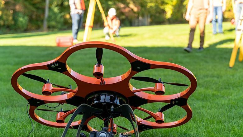
Surveyors apply their knowledge and skills for such purposes as field data collection, statistical analysis, mapping, boundary location, and wetland delineation. They identify and locate hazardous waste sites and tectonic plate movements, map areas such as the polar ice cap and deforestation in the Amazon River basin, and collect and present data used by land planners and environmental agencies. Data is obtained from digital ground-based surveying equipment, aerial photos, and satellites.
Planners and legislators rely on the data generated and analyzed by surveyors for the information they need to make decisions. One well-known use of the technology employed by surveyors is the support mapping for the 911 emergency phone system. More familiar products provided by surveyors include road and city maps, building layouts, maps of the moon and planets, and diagrams showing population growth.
There are many areas of specialization in the discipline of surveying. You can become a:
- Land/Boundary Surveyor
- Construction Surveyor
- Photogrammetrist/Image Analyst
- Geospatial/Remote Sensing Analyst
- Hydrographic Surveyor
- Geodesist
- Geographical Information Systems Specialist
Who hires surveying graduates?
The Surveying Engineering major provides an undergraduate degree suited for both private and public service in the profession of surveying. Surveying Engineering leaders are sought after everywhere, including the government sector and private firms. You can work for:
- Engineering and Architectural Firms
- Construction Companies
- Land Development Planners
- Environmental Agencies
- Oil and Natural Gas Companies
- Public Utilities
- Railroads
- Federal, State and Local Government Agencies
Federal, state, and local government agencies employ almost one-third of all surveyors. Among the federal agencies employing these workers are:
- Bureau of Land Management
- National Geodetic Survey
- U.S. Geological Survey
- U.S. Army Corps of Engineers
- U.S. Forest Service
- National Geospatial-Intelligence Agency
On the state and local levels, surveyors find employment with private land surveyors, highway departments, and urban planning and development agencies. There are also opportunities with construction companies, engineering and architectural firms, crude petroleum or natural gas companies, railroads, and public utilities.
Leadership and Entrepreneurial Opportunities
Surveying students who minor in business or engineering leadership development have the potential to be entrepreneurs, lead teams, develop and manage projects, and work as freelancers.
Professional Licensing for Surveyors
Please note: Many U.S. states and territories require professional licensure/certification for employment in the field of surveying, and in some locations a baccalaureate degree is required for licensing. Read more about licensing requirements and how licensing is obtained in Pennsylvania.
Professional Surveying Organizations
- National Society of Professional Surveyors
- American Society for Photogrammetry and Remote Sensing
- International Federation of Surveyors
- International Society for Photogrammetry and Remote Sensing
- Pennsylvania Society of Land Surveyors
- Urban and Regional Information Systems Association
Legal notices:
- Portions © 2001 Trimble Integrated Technologies. All rights reserved.
- Portions © 2001 Leica Geosystems, Inc. All rights reserved.
- Portions © 2001 Topcon Positioning Systems. All rights reserved.
- Portions © 2001 Trimble Navigation Limited. All rights reserved.
- Portions National Geodetic Survey
- Portions National Geospatial-Intelligence Agency


