Using specialized, extremely high-quality photographic equipment, it is possible to capture images (shown below) from either planes or satellites that can be used to map the earth. By overlapping these images, three-dimensional views of the earth can be obtained. This process is known as photogrammetry, which is an area of study in surveying. In the past, instruments known as stereoplotters were used to recreate the three-dimensional view of the object. Today much of this work can be performed on computers using digital imagery. This method of mapping the earth's surface is responsible for products such as road maps, highway design maps, and topographic maps, to name a few. People who perform this work are known as photogrammetrists. A photogrammetrist must have a strong background in mathematics and computers.
Photogrammetry can be used to determine the three-dimensional coordinates of any point in the image. The photogrammetrist uses this information to create base maps in support of other engineering and civilian projects. Examples of maps developed using photogrammetry include highway and topographic maps. Photogrammetrists in the United States Geological Survey produce a well-known series of maps covering the entire United States known as quadrangle (quad) sheets. These maps are often used by sportsmen.
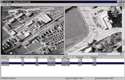 View of computer screen showing coordinates of measured points
Another branch of image analysis involves the identification of objects on an image. Often these images are taken using the infrared bands of the electromagnetic spectrum from satellites. These images allow a trained person to identify items as small as a person. These images are often used to perform assessment of environmental factors. For instance, the spread of an uncontrolled fire can be monitored each hour to identify the hot spots, and its progress allowing planners to best utilize limited resources. Similarly, monitoring of insect infestation in a forest can be easily performed from these images. The people who work in this branch of surveying are known as image analysts. Like photogrammetrists, these people also need a strong background in mathematics and computers. Often students study both of these areas of surveying, and are classified as image analysts.
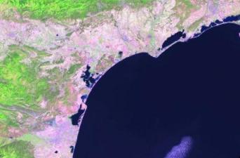 Satellite image of the western Mediterranean over Barcelona, Spain and southern France.
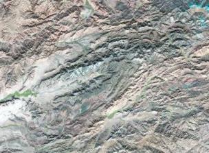 Satellite image over Afghanistan.
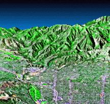 Image from Shuttle Radar Topography Mission of Pasadena, CA.