Imagine that you are planning a trip in a foreign country. Two items you would probably wish to carry along are a map and compass. With the map, you can locate yourself and with the compass and simple pacing, you can navigate from location to location as depicted on the map. This process is known as orienteering and is similar to the surveying process used in making maps.
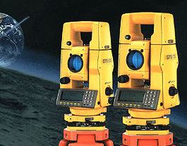
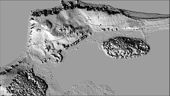
From ancient times, people needed to map our planet. Ancient maps generally showed land masses relative to each other, but lacked the precision that is required for today's applications. Today we need precise maps for project planning. These maps are created using a variety of tools. Similar to the compass and pacing, the most commonly used tools precisely measure distances and angles between objects. These instruments, known as total stations, carry on-board digital processors that collect the data, store it, and retrieve it as is needed. From this data, relative coordinates are determined using trigonometry, and maps like the one shown below are developed.
Additional tools available to surveyors for mapping small areas include a process known as LIght, Detection, And Ranging, or LIDAR. This tool can automatically and accurately measure distances (ranges) and angles to objects that would be difficult to physically measure. These observations are used to create three-dimensional images of the objects. Other methods of producing accurate three-dimensional images of objects and the ground include aerial and satellite imagery, the global positioning system, sonar, and radar.
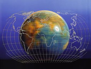
With the observed angles and distances, trigonometry can be used to determine the coordinates of points in the image. However, the mathematics of trigonometry is only adequate for small surveys. For surveys covering larger areas, the circular nature of the Earth must be considered. Since our view of the earth is limited, we often forget that our planet is a sphere. This simple fact is important to a pilot that is attempting to navigate over long distances. Pilots depend on accurate maps produced by surveyors to guide them. In fact, many professions depend on the surveying profession to establish reliable coordinate systems over large areas of the earth. To accomplish this, surveyors can work directly in a curvilinear coordinate system such as latitude, longitude, and elevation, or they can use map projections where mathematically rigorous equations are used to project a curvilinear coordinate system onto a flat map sheet as depicted to the right.
Before the astronauts landed on the moon, surveyors used images of the moon to create an overall lunar map, and detailed maps of potential landing sites. The first unmanned vehicles to Mars returned images for the purpose of mapping. In fact, historically, the first expeditions endeavored in any uncharted region have been performed by surveyors. Lewis and Clark were astute cartographers and surveyors who mapped the new lands they encountered expedition known as the "Corps of Discovery." Mason and Dixon laid out the southern border of Pennsylvania. Even today, surveyors are mapping virgin regions of Alaska, and the Rocky Mountains. Surveying has a proud heritage of famous people in the United States. The skills required to become a surveyor include an aptitude in mathematics, willingness to work with other professionals, ability to communicate one's work to layman, and ability to arbitrate disputes that inevitably arise over boundaries.