Light Detection and Ranging
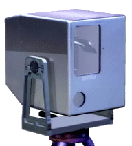
LIDAR combines a laser ranging system with precisely calibrated rotating mirrors to determine surface coordinates of objects. The resultant system of coordinates known as a point cloud are shown in the following images. The instrument shown to the right is connected to a computer to produce real-time three-dimensional images of objects being scanned. Similar type instruments can be mounted in airplanes or satellites to provide surface modeling of the earth. The resultant images are used by professionals such as engineers, architects, and archeologist to obtain precise measurements, and to aid in project design. Examples of some of the images of this tool are shown below.
 Three-dimensional image of a bridge showing its elements.
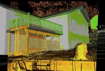 Three-dimensional image of a house. Note the child's car in the forefront of the image.
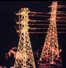 Three-dimensional image of a high tension power line.
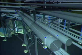
As an example of their use, this image shows how the three-dimensional image can be used to check for obstructions. Note that the two pipes in the foreground are being routed to avoid the existing structures and piping. This capability allows engineers to avoid obstructions during the design phase. The following image depicts another routing problem being checked during the design phase. This capability save money for the contractor by avoiding problems before the construction phase is started.
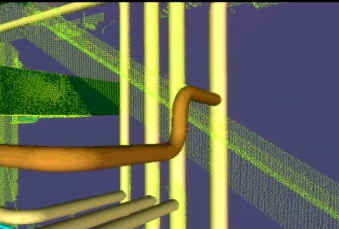 Note how the new pipe shown in brown has been routed around the existing obstruction.