Since ancient times, man has made measurements in an attempt to determine the exact size and shape of the earth. Additionally, maps of the known world have been created for use in navigation. Today the need to determine the exact size, shape, and motions of the earth are important nationally and internationally in land use planning, shipping, transportation, and space exploration. The creation of map projections is a subject of geodesy. To enable users to tie maps together, monumented points with known coordinates are created. These points are used to control projects in aerial, boundary, construction, and hydrographic surveys.
Geodesy is the field that explores the exact size, shape, and motions of the earth. In this process, geodesists create a network of monumented points on the earth's surface with coordinates. In the past these coordinate systems have been locally derived, but with the advent of international travel and space exploration, world-wide coordinate systems have been created. Part of the study of geodesy are the fluctuations in strength the earth's gravitational and magnetic fields. These fluctuations affect several areas of study as well as other branches of surveying. The two images below are maps of the earth's gravitational and magnetic fields.
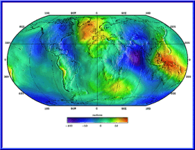 Gravitational map of earth.
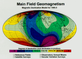 Map of the Earth's magnetic declination in 1995.
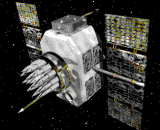 Traditionally, these coordinate systems were created by observing the stars. Today the Global Positioning System (GPS) is used to determine precise positions of these monuments to within a centimeter. This system of 24 satellites creates a network of precisely known positions orbiting the earth. Using signals broadcast from these satellites, precise positioning, navigation, and timing are possible.
Geodesist work closely with all branches of surveying, as well as other professionals such as geophysicists. They need knowledge in upper-level mathematics and physics to define and create models of the earth.